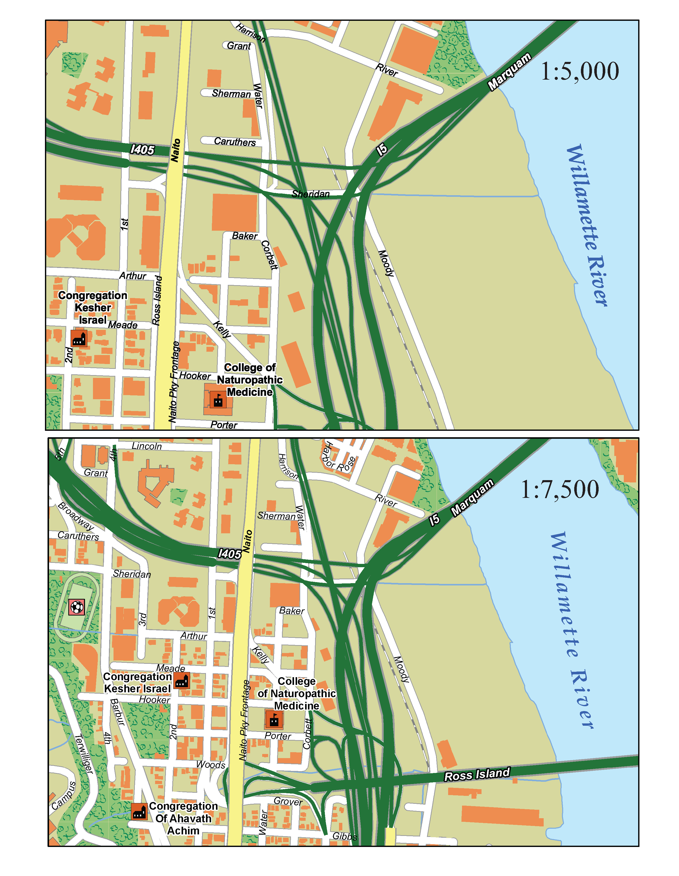
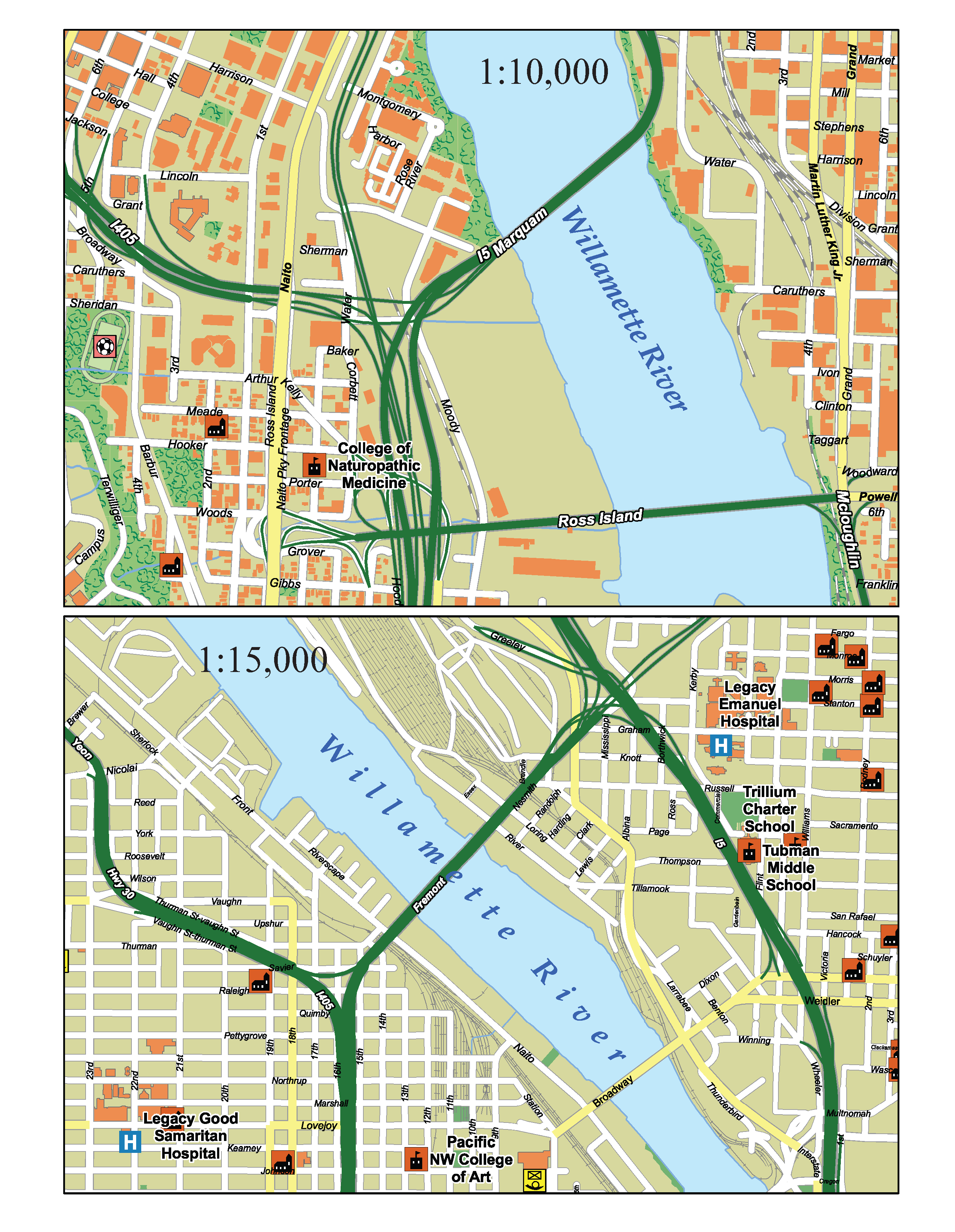
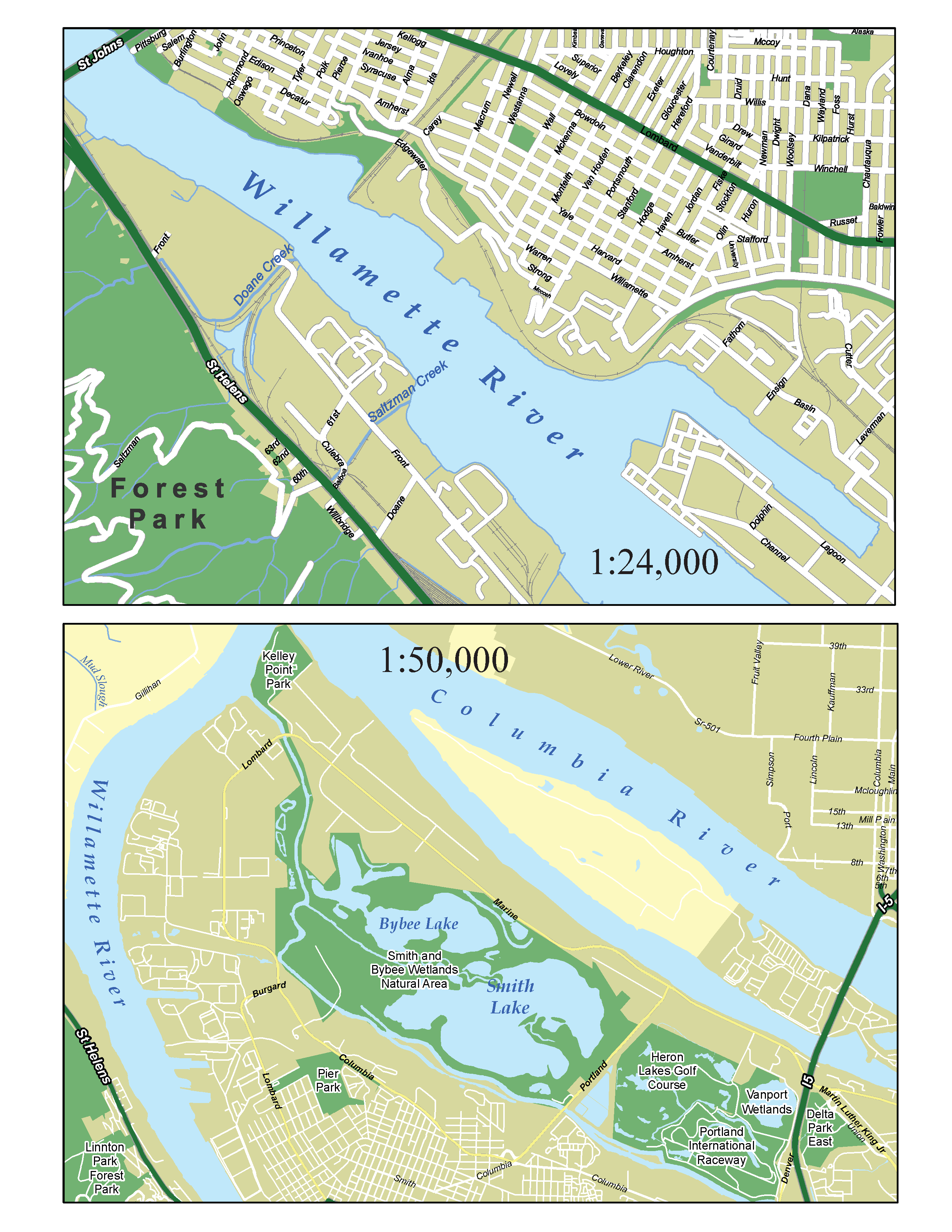
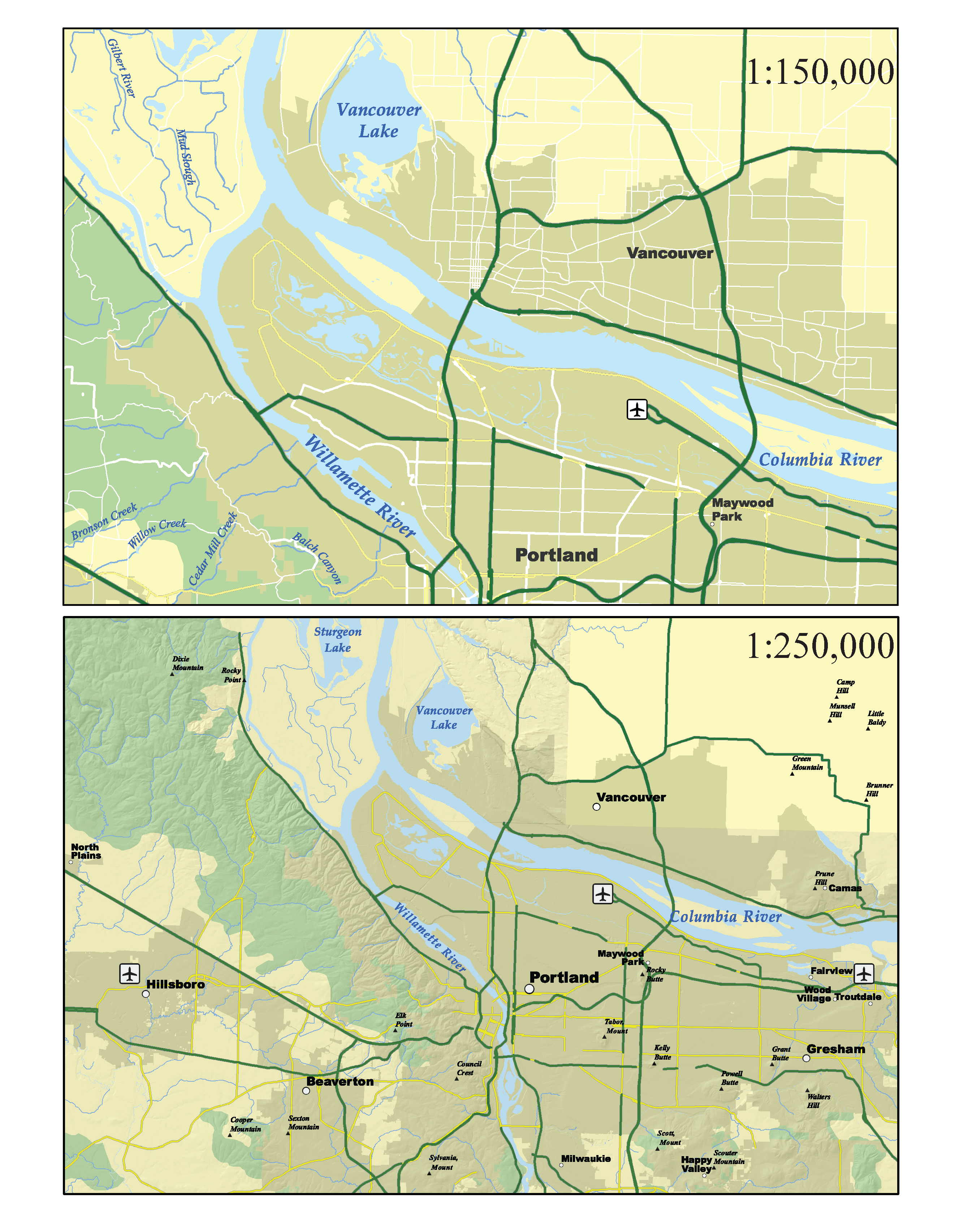
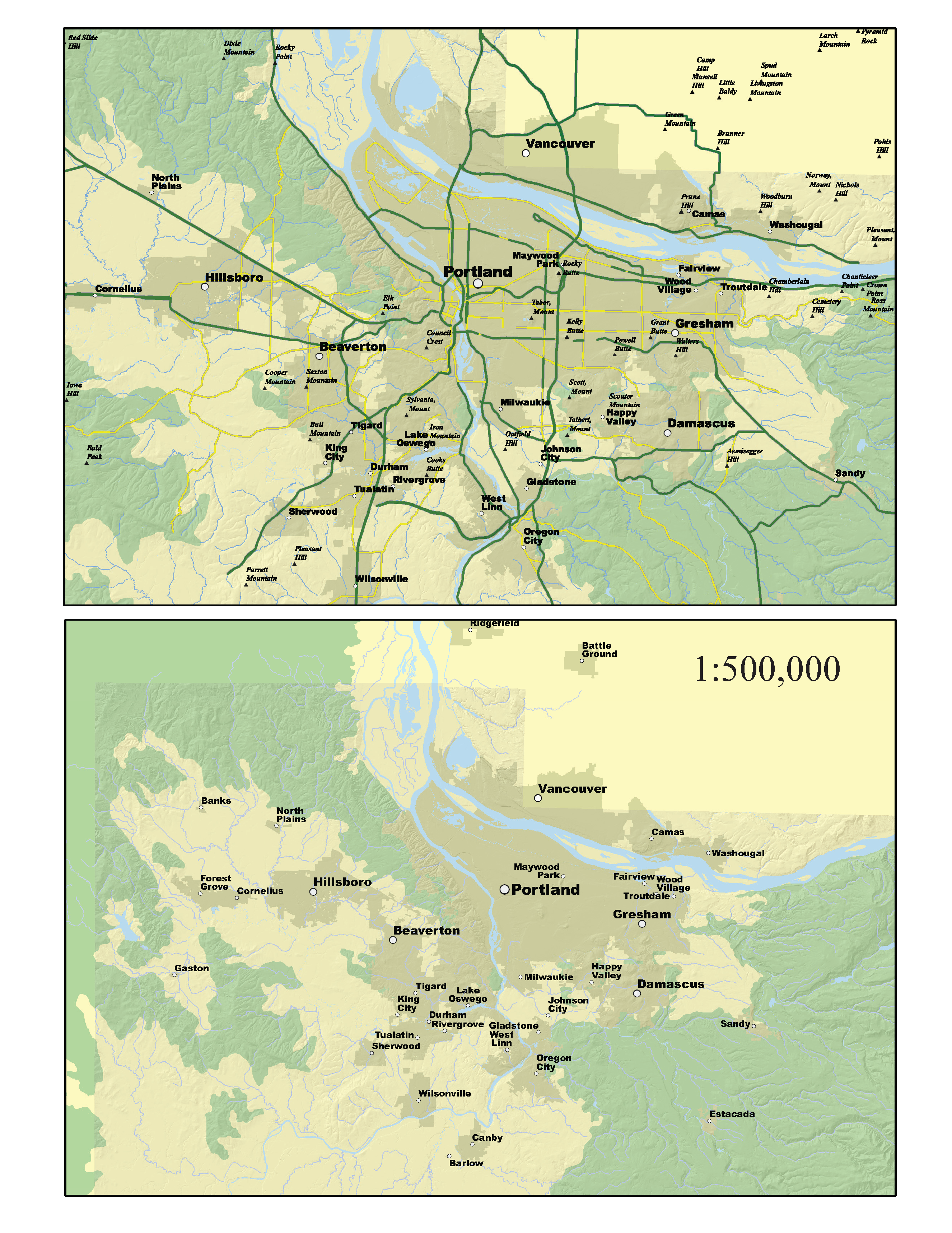
 Student project for determining which display settings are appropriate at which scales. City streets, for example, might only display at 1:50,000 and larger scales, while highways might display at scales as small as 1:500,000. All maps were created in a single, dynamic ArcMap document that updated the display based on the zoom level. Automated labeling in Maplex, with no custom annotations.