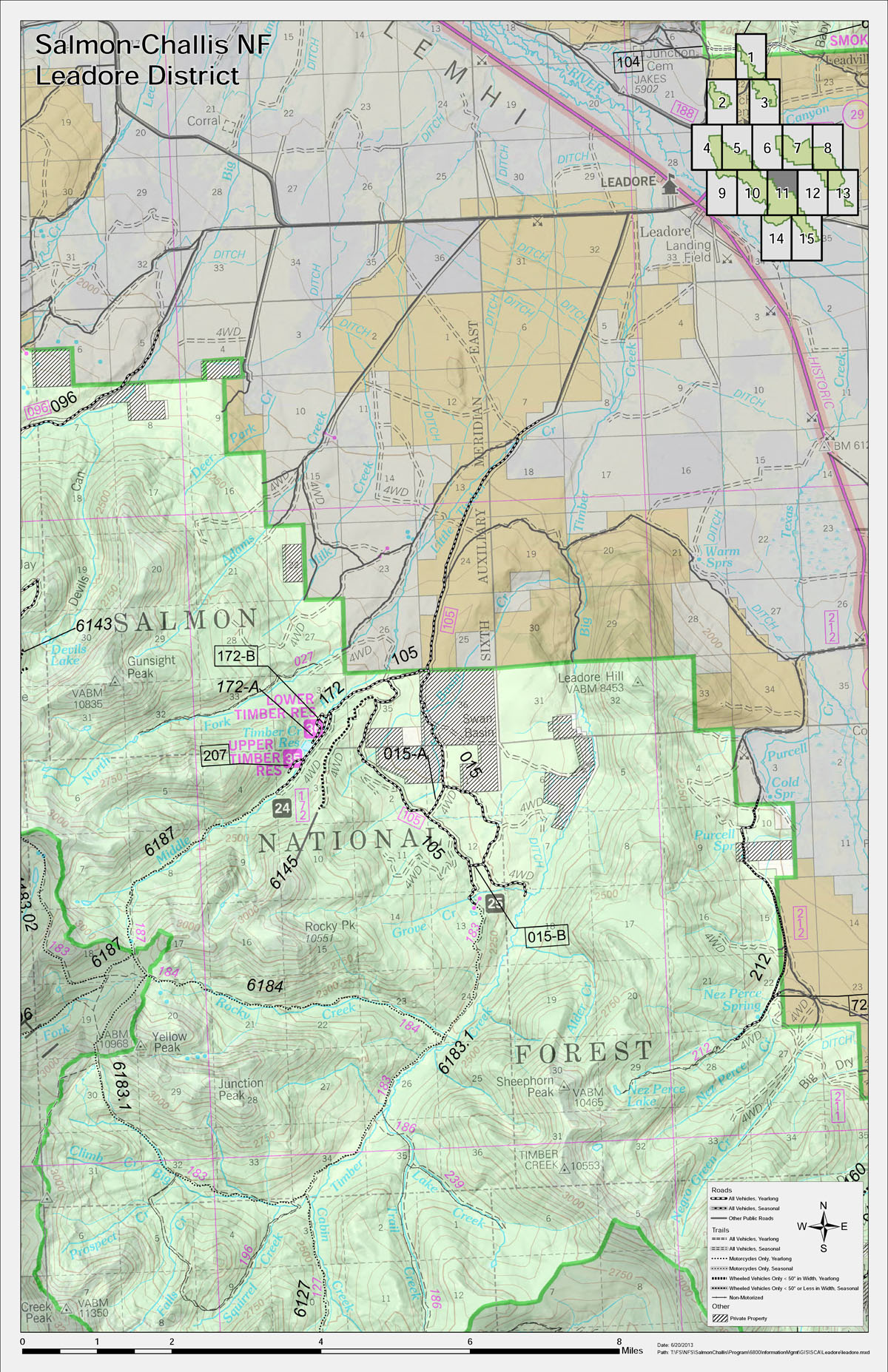
This set of 15 poster-sized, laminated maps was made for the Leadore Ranger District for use with the public. It overlays data from the latest travel plan on top of an enlargement of the existing base map and a hillshade. An inset map in the upper right displays the position of the larger map relative to the other mapsheets in the district. The use of data driven pages minimized the time and effort required to create the original map set, and updates or similar sets of other districts can be created with relatively little additional work.