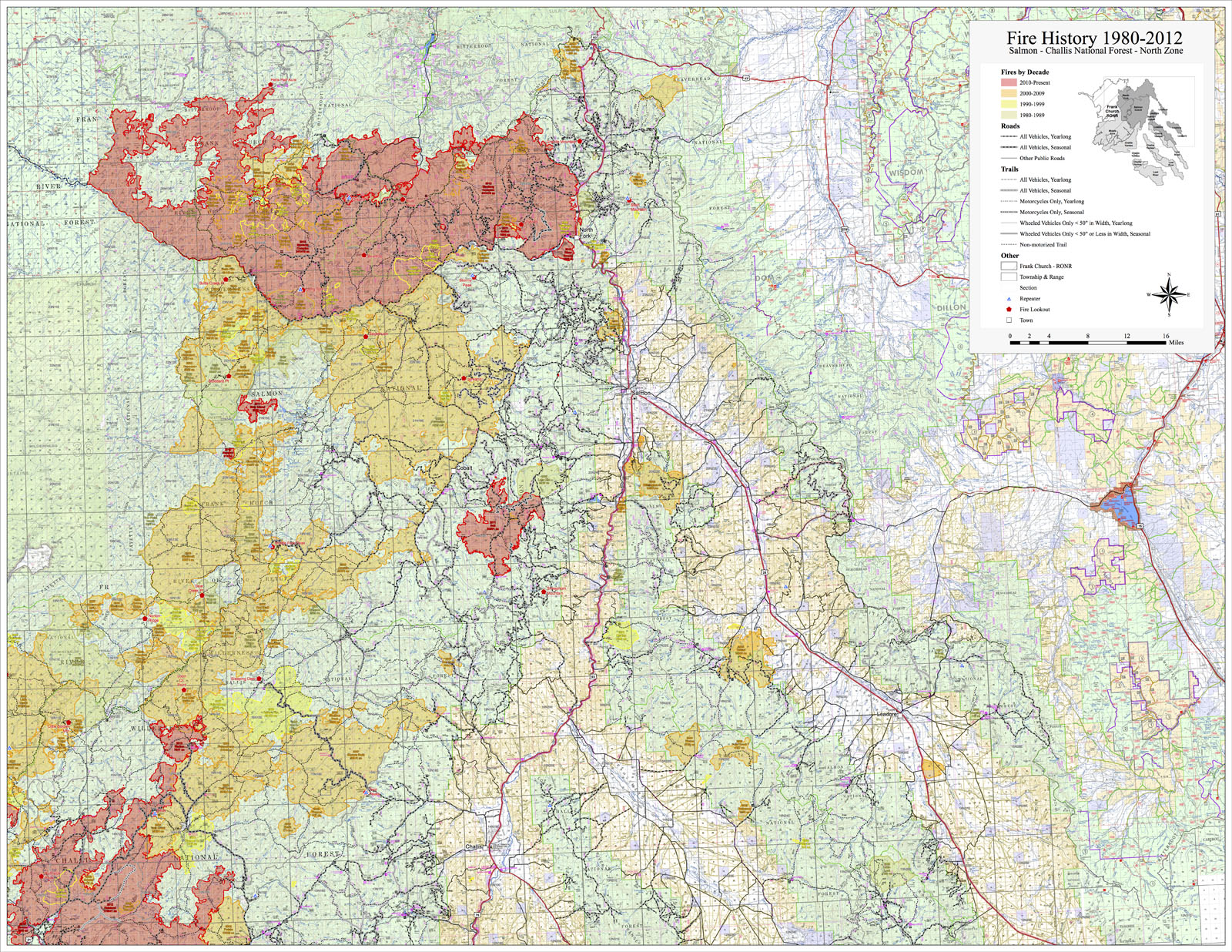
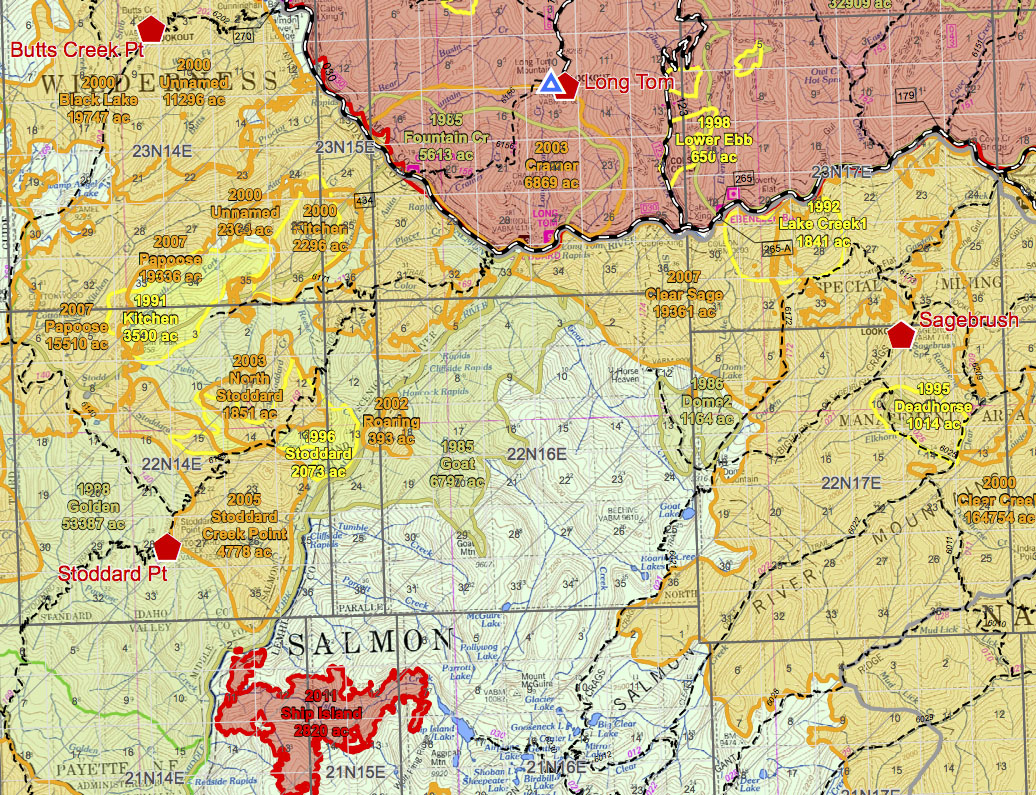
There were several decades of forest fire outlines for the Salmon-Challis and surrounding national forests, and fire crews needed a map showing the history of these fires for planning purposes. Mostly this became a symbology and labeling challenge since the fire data needed to be displayed over an already detailed base map. Additionally, the travel plan, lookout points, repeaters, and township and range needed to be shown. Since adjacent forests also needed to be included, and some of them had base maps or fire data in different formats, seamlessly integrating those sources was a challenge as well. Labeling each individual fire in a way that would clearly identify it and it alone, despite fires overlapping and sometimes have non-contiguous boundaries, required a combination of complicated Maplex labeling rules and manual editing once the automatic placement was as good as it could be.